
Weather alert: Aveyron on orange alert for rain and thunderstorms with overflows predicted from the Tarn in the next 24 hours
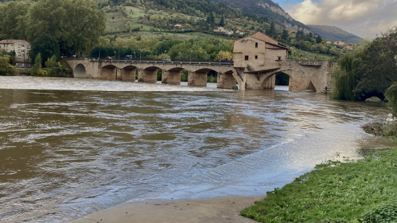
Ce jeudi matin, au niveau du pont Lerouge à Millau, le Tarn est déjà à des hauteurs de débordement. MIDI LIBRE – F.MAYET
Classified in orange rain-storm alert, Aveyron will experience, this Thursday, October 17 in the afternoon, heavy rainfall with, locally, up to 60 millimeters of accumulation on already wet soils. At the same time, the Tarn will reach overflow levels, like the Dourbie in the Nant sector.
This Thursday, October 17, during the afternoon, a rain and storm system will approach Aveyron, placed on orange alert, from the west, moving very slowly towards the east. As it passes, the precipitation will be particularly intense with accumulations of 20 to 40 millimeters in the department and locally, 50 to 60 millimeters, on already particularly wet soils. The storm cells are expected to subside by early evening.
Ce jeudi matin le Tarn a beaucoup monté au niveau du pont Lerouge à @villedemillau @MidiLibreMillau #meteo pic.twitter.com/JHyl5Jq572
— Mayet Frédéric (@MayetFrdric) October 17, 2024
The rains, however, will linger until the morning of Friday, October 18, before also fading away. In total, over the episode, accumulations of around 50 to 70 mm are expected in the department, and locally 70 to 100 mm in the north-west of Aveyron. It should be noted that these stormy phenomena, potentially quite violent, should be accompanied, beyond the high rainfall intensities, by a risk of significant average hail and a risk of strong to very strong gusts of wind, potentially between 80 and 100 km/h.
Risk of a significant flood of the Tarn
At the same time, the hydrological services are predicting a significant flood of the Tarn in the next 24 hours in the municipalities of Aguessac, Compeyre, La Cresse, La Roque-Sainte-Marguerite, Millau, Mostuéjouls, Nant, Paulhe, Peyreleau, Rivière-sur-Tarn, Saint-André-de-Vézines, Saint-Jean-du-Bruel and Veyreau. The Mediterranean episode will continue until the night of this Thursday 17 to Friday 18 October with 2 to 3 peaks of intensity.
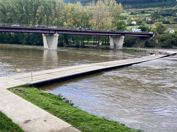
At the Saoutadou footbridge, closed since this Wednesday in Millau. MIDI LIBRE – F.MAYET
Currently, this episode is already causing overflows in the Montbrun and Florac areas. After a temporary decrease in the afternoon of this Wednesday, a reactivation of the rains is underway. The water levels of the rivers have started to rise again and this will continue all day on Thursday 17 October until reaching their maximum levels on Thursday evening or even on Friday night 18 October.
Overflowing of the Dourbie in the Nant area
In addition to the Tarn and the Tarnon, on Thursday evening, the first overflows could also affect the Dourbie in the Nant areaand to a lesser extent, the Jonte in the Meyrueis area. In the Montbrun area, these reactions should lead to widespread overflows.
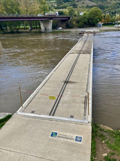
Wood jams on the Saoutadou footbridge, which has been closed to access since Wednesday, October 16 in Millau. MIDI LIBRE – F.MAYET
Significant flooding is possible. Traffic conditions may be difficult across the entire network and disruptions may affect rail transport. Power cuts may occur. Dikes may be weakened or submerged.
Related Posts
-
 “If they had watched my mother…”: missing from the emergency room, an old lady found dead in a hospital trash can
-
 Between tradition and new winds, the Aguessac festival committee is preparing
-
 “She scares the whole residence”: slap, death threats, an aggressive neighbor in court, in Montpellier
-
 A demonstration announced in Nîmes on Thursday June 20 to say “stop fascism and colonialism!”