
MAPS Find out how the sea will eat away at housing on the French coast and where the most threatened areas are
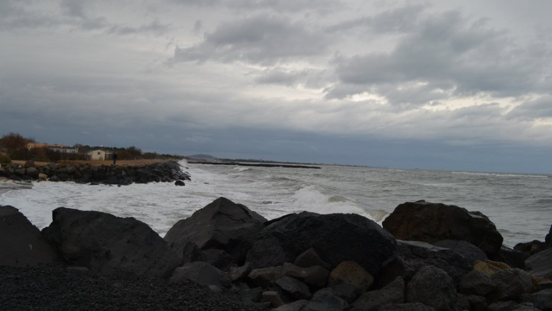
In Vias Plage, development of the west coastline. Midi Libre – JEAN PIERRE AMARGER
The different projection maps of the effects of climate change have been revealed. They are instructive.
It’is "a phenomenon which is accelerating", underlined, Thursday evening, Christophe Béchu, Minister of Ecological Transition and Territorial Cohesion, guest in Gilles Bouleau's 20 Heures newspaper, on TF1.
According to maps from Cerema (Center for studies and expertise on risks, the environment, mobility and planning), commissioned by the government and published Friday, under the effect of the retreat of the coastline, amplified by climate change, the erosion which threatens housing now concerns 20% of the French coastline, or 900 km.
Many campsites under threat
Rising sea levels could threaten 1,046 buildings within four years. In 2050, using the most credible scenario, i.e. a rise of one meter in sea level, 5,200 housing units would this time be affected, as well as some 1,400 offices and shops.
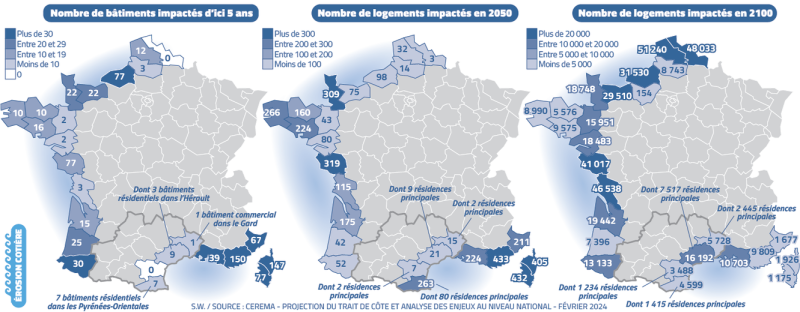
Click to enlarge. S.W.
If nothing is done by 2100, the ocean will attack even 450,000 homes and 55,000 offices and businesses. 982 campsites would be impacted in 2100. "Three departments, Vendée, Charente-Maritime and Hérault, would each have more than 100 campsites affected", specifies Cerema.
"Customized plans"
At the national level, this would represent nearly 2,300 hectares of campsites potentially impacted, corresponding to an average impact of 47% of their total area.
An upheaval for the tourist resources of these territories. 500 municipalities at risk have already been identified and the government is working with mayors to put in place, for them, "tailor-made plans", explained Christophe Béchu on the 20-Heures set, emphasizing that "the urban planning documents"& nbsp;were going to be "revised" based on the maps.
It is almost certain that this type of event will occur again in the coming decades and more frequently
"The retreat of the coastline of sandy coasts is largely conditioned by the effects of major storms or the cumulative effect of series of storms, like those of winter 2013 -2014. It is almost certain that this type of event will occur again in the coming decades and more frequently due to the effects of climate change", explain Cerema experts .
"No national solution that can be applied everywhere on the territory"
"This study shows that we should not wait to adapt and that the scenario of inaction, that of 2100 , has an extremely strong impact, both from an economic point of view and from our ability to live on the coastal territories", explains Sébastien Dupray, Director of Risks, Water, Sea of Cerema, cited by AFP and Huffingtonpost.
He recalls that in fifty years "we have lost around 30 km², or 4 200 football fields" on the French coast. "There is no national solution that we can implement everywhere on the territory, because the coasts of Camargue are low and sandy, while the coasts of Normandy are high with chalk cliffs, he warns.
Related Posts
-
 In Alès, next September, the teaching staff of the Royale school will be decimated
-
 “In the name of Allah, I will kill her”: threatened with death by a high school student, a teacher files a complaint
-
 Four people poisoned by smoke following a hob fire in an apartment in Montpellier
-
 War in Ukraine: transfer of Mirage 2000-5 to kyiv, Russian refinery on fire… update on the situation